")


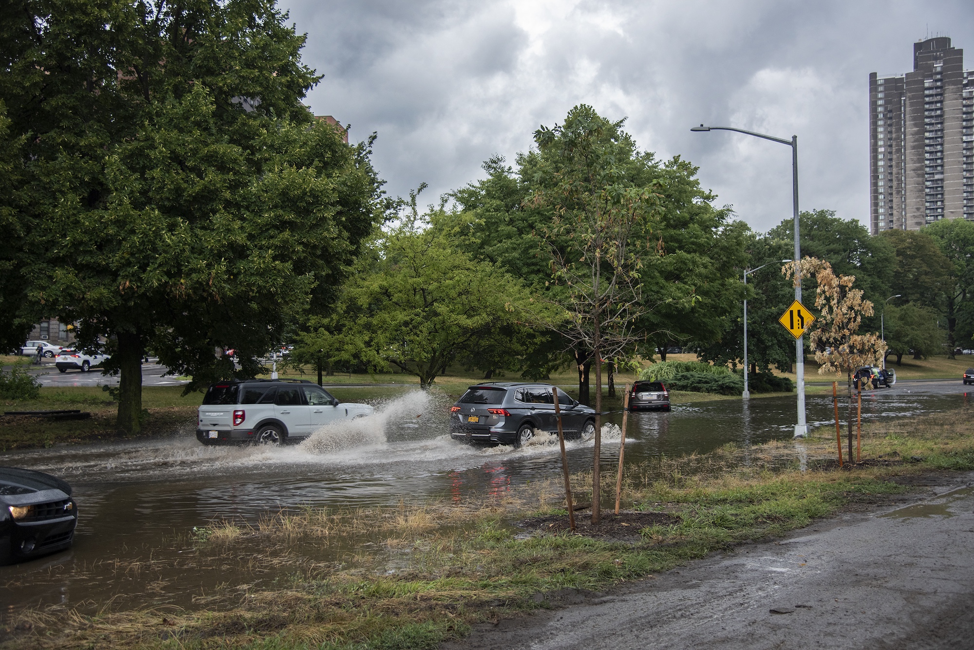
Photo credit: José A. Giralt
Editor’s Note: Norwood News is officially on our annual summer hiatus. However, we are continuing to publish some ad hoc stories online that we couldn’t get to earlier this year. We hope everyone gets some time to enjoy the last few weeks of summer and thanks, as always, for reading.
The New York branch of the National Weather Service (NWS) advised on Saturday that there is potential for isolated severe thunderstorms on Sunday, Aug. 17, with damaging winds being the primary threat.
NWS officials said the Storm Prediction Center has put the area in a marginal risk for severe storms, with the highest likelihood of impact north and west of New York City and the lowest across eastern Long Island and Connecticut.
They said expected timing as of Saturday looks like storms may arise in the late afternoon and into the early evening on Sunday coming from the northwest to the southeast, and with the severe threat diminishing after about 9 p.m.
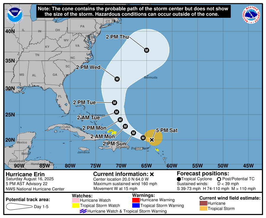
Image courtesy of the National Weather Service
NWS officials said they are also continuing to monitor Hurricane Erin through early next week and colleagues at the National Hurricane Center are forecasting it to track north of Puerto Rico this weekend. They said Erin is then forecast to gradually turn northwestward, and then northward as a large and powerful hurricane early this week.
They said the majority of model consensus keeps the center of Erin well east of the U.S. East Coast and curving northeast into the open Atlantic next week, but added that there is inherently uncertainty on the exact track, size and intensity of Erin this far out.
They said steering mechanisms for tropical systems are subtle, and encourage New Yorkers to continue to follow the latest official forecast information from the National Hurricane Center (NHC) and NWS’s local office for awareness on any local threat.
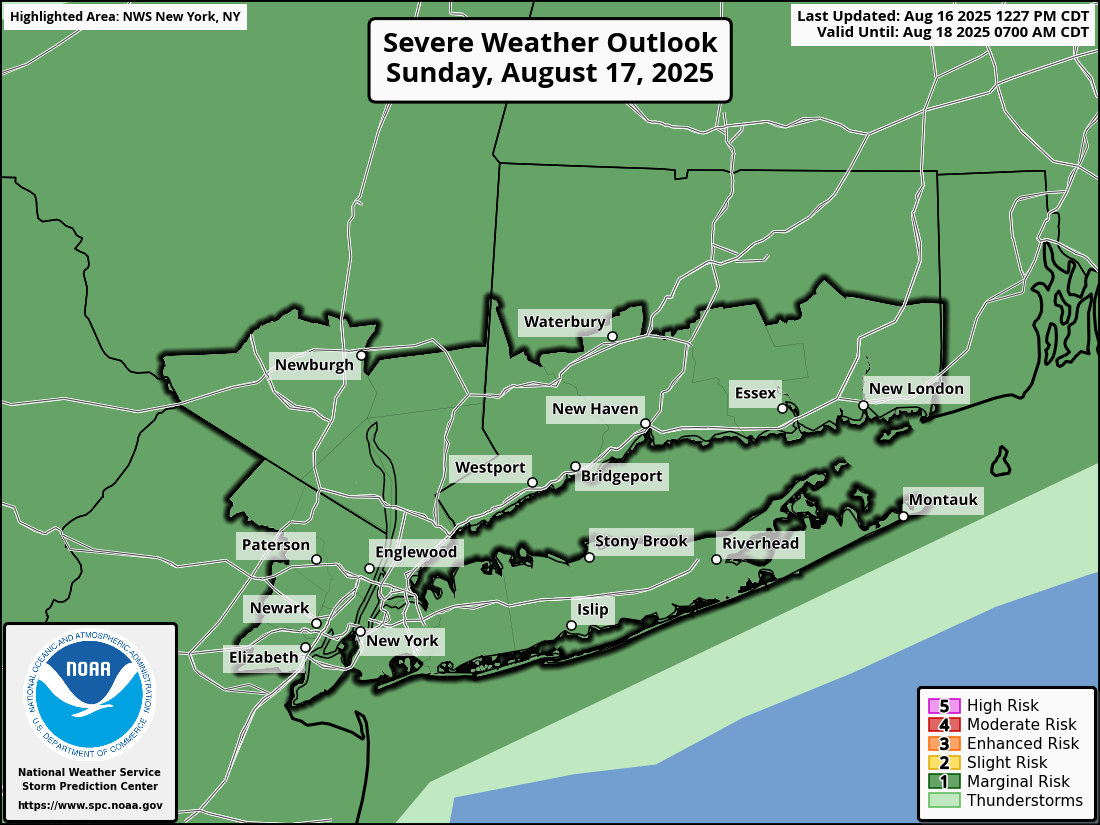
Image courtesy of courtesy of the National Weather Service
NWS warned of the following potential hazards and impacts next week:
- High surf and dangerous rip currents: Likely at Atlantic Ocean beaches Tuesday, Aug. 19, through Friday, Aug. 22.
- Shoreline impacts: Likely areas of ocean beach erosion and flooding, with scattered areas of dune erosion, during times of high tide Tuesday, Aug. 19, through Friday, Aug. 22. Localized minor coastal flooding possible for vulnerable coastal locales as well.
- Marine: Seas are likely to build to 10 to 15 ft late Wednesday, Aug. 20, into Thursday, Aug. 21, and then subside into next weekend.
They said the next update will be sent by 6 p.m. EDT Monday, Aug. 18. and they urge anyone with questions in the interim or anyone who may need additional information not to hesitate to contact NWS by phone, email, or through NWSChat.
admin
Welcome to the Norwood News, a bi-weekly community newspaper that primarily serves the northwest Bronx communities of Norwood, Bedford Park, Fordham and University Heights. Through our Breaking Bronx blog, we focus on news and information for those neighborhoods, but aim to cover as much Bronx-related news as possible. Founded in 1988 by Mosholu Preservation Corporation, a not-for-profit affiliate of Montefiore Medical Center, the Norwood News began as a monthly and grew to a bi-weekly in 1994. In September 2003 the paper expanded to cover University Heights and now covers all the neighborhoods of Community District 7. The Norwood News exists to foster communication among citizens and organizations and to be a tool for neighborhood development efforts. The Norwood News runs the Bronx Youth Journalism Heard, a journalism training program for Bronx high school students. As you navigate this website, please let us know if you discover any glitches or if you have any suggestions. We’d love to hear from you. You can send e-mails to norwoodnews@norwoodnews.org or call us anytime (718) 324-4998.